Difference between revisions of "Display the Area and Length of a Polygon"
From IMSMA Wiki
(Version 6.0) |
|||
| Line 4: | Line 4: | ||
<li>Click the [[Image:MouseIcon.png]] button.</li> | <li>Click the [[Image:MouseIcon.png]] button.</li> | ||
<li>Select the polygon or line from the map.</li> | <li>Select the polygon or line from the map.</li> | ||
| + | <li>Click the [[Image:MouseIcon.png]] button again.</li> | ||
</ol> | </ol> | ||
::The selected line or polygon is outlined in blue. The area and/or length displays in the lower, left corner of the map pane. | ::The selected line or polygon is outlined in blue. The area and/or length displays in the lower, left corner of the map pane. | ||
Revision as of 19:16, 13 January 2014
To display the area and length of a polygon, or the length of a line:
- Zoom in close enough to the icon for which you would like to display the area and length.
- Click the
 button.
 - Select the polygon or line from the map.
- Click the
 button again.
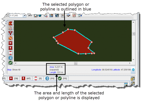
- The selected line or polygon is outlined in blue. The area and/or length displays in the lower, left corner of the map pane.
Area and Length Example
