Difference between revisions of "Change existing symbol in IMSMA.mxd"
From IMSMA Wiki
| Line 40: | Line 40: | ||
<li>Verify in Map Display that the changes are applied.</li> | <li>Verify in Map Display that the changes are applied.</li> | ||
</ol> | </ol> | ||
| − | |||
| − | |||
{{NavBox HowTo Setting up Maps}} | {{NavBox HowTo Setting up Maps}} | ||
| − | |||
[[Category:CRI]] | [[Category:CRI]] | ||
Revision as of 23:48, 27 June 2015
If you would like to change the existing symbols, you need to use ArcGIS software to update IMSMA.mxd which is located in C:\IMSMAng\server\gis\maps folder.
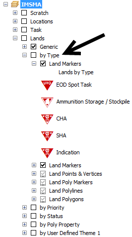
As example Land by Type will be used.
IMSMA layer Land - by Type
- Double-click on the symbol that you would like to change (SHA).
- The following window displays.
- You can change a form, colour, size, angle, mask etc. For Advanced editing, click on the symbol.
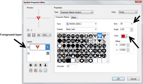
- The following window displays.
- If you would like to change the colour of the symbol then select the foreground layer and a colour.
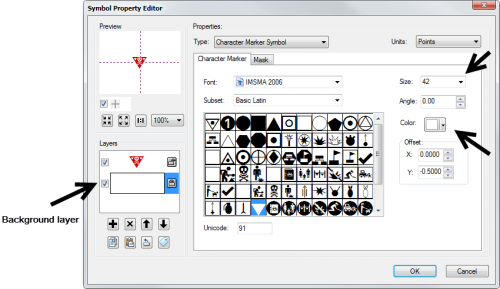
- If you would like to change the background colour then select the background layer and a colour.
- Click on OK to close the Symbol editor.
- Click on OK to close the Marker property window.
- Apply the same change to the other layers in the same group.
- Save the IMSMA.mxd and close ArcMap.
- Rename your background mxd. This mxd must not previously been merged/imported into IMSMANG.
- In the IMSMA client (if your configuration is client/server then start the IMSMA client on the server computer) go to File, Import, Map.
- Import the background map which will be merged with the updated IMSMA.mxd.
- Verify in Map Display that the changes are applied.
Marker properties
Symbol editor - Foreground
Symbol editor - Background
| |
The size is different in the foreground and background layers of the symbol. |
IMSMA layer Land - by Type
| |||||||||||||


