Open main menu
  • Edit

GIS Preview from Workbench

Revision as of 17:20, 13 March 2015 by Alnaucler (talk | contribs)
(diff) ← Older revision | Latest revision (diff) | Newer revision → (diff)

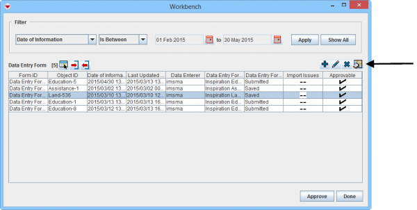
Data Entry Forms in the Workbench that contain geospatial data can be displayed on the map.

To display Workbench Data Entry Form's geospatial data on the map:

    WB GIS Preview1.png
    Workbench window
  1. Select a Data Entry Form and click the DispGeoData.png button.

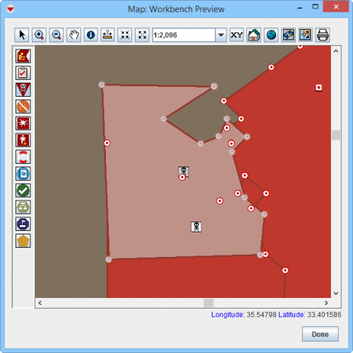
  2. WB GIS Preview.png
    Workbench Preview window
  3. The Map: Workbench Preview window displays. All themes are enabled by default.
Using IMSMANG
Reconciling and Approving Data in IMSMANG
Reconcile
Reconcile started from Data Entry Menu
Reconcile as New · Reconcile as Existing Item
Reconcile started from Summary Window
Add from Summary Window · Update from Summary Window · Delete from Summary Window
Other Reconcile Actions
Link to Existing Item · Reassign Item to another Location · Unlink Items · Unapprove a Data Entry Form
Approve
Save Data Entry Forms · Submit Data Entry Forms · Reject Data Entry Forms · Approve Data Entry Forms · Approve Data Entry Forms from the Workbench
Workbench
Filter Data Entry Forms Displayed in Workbench · GIS Preview from Workbench · Export Data Entry Form from Workbench · Delete Data Entry Form from Workbench · View or Change Data Entry Form from Workbench
Retrieved from "http://mwiki.gichd.org:8090/mediawiki/index.php?title=GIS_Preview_from_Workbench&oldid=19279"
Last edited on 18 March 2019, at 08:58

IMSMA Wiki

  • Privacy
  • Desktop