GIS Preview from Workbench
From IMSMA Wiki
Data Entry Forms in the Workbench that contain geospatial data can be displayed on the map.
To display Workbench Data Entry Form's geospatial data on the map:
- Select a Data Entry Form and click the
 button.
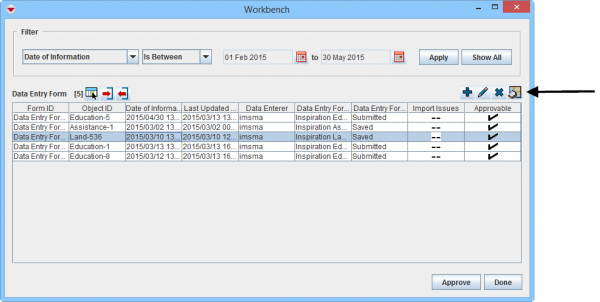 Workbench window
 - The Map: Workbench Preview window displays. All themes are enabled by default.
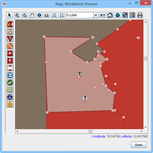 Workbench Preview window


| |
More functions have been added to the Preview window. It amongst other things possible to add labels. It is also possible to change the order of the themes. |
| |||||||||||||||||||||