Difference between revisions of "Image Processing and Spatial Analysis workflows"
| (15 intermediate revisions by 2 users not shown) | |||
| Line 1: | Line 1: | ||
| − | <u>Spatial Analysis | + | {{TOC right}} |
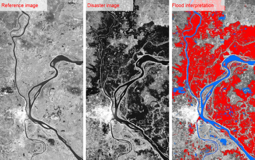
| − | + | [[Image:RasterAnalysis Example.png|500px|center]] | |
| − | + | Below you will find links to useful websites for ESRI, MapInfo, QGIS and ERDAS. The links are a mix of training sessions, user manuals, blogs and video walk-throughs. If you do not find what you are looking for here then have a look at the '''[[Portal:Training | Training portal]]''' and the '''[[GIS Forums | GIS Forums page]]'''. | |
| − | + | ==ESRI==__NOEDITSECTION__ | |
| − | + | <u>ESRI's training catalog Spatial Analysis</u><br/> | |
| − | :[http://training.esri.com/gateway/index.cfm?fa= | + | :[http://training.esri.com/gateway/index.cfm?fa=search.results&searchterm=spatial+analysis Training Seminar] |
<u>Spatial Analysis Extension Tool (ESRI)</u><br/> | <u>Spatial Analysis Extension Tool (ESRI)</u><br/> | ||
| − | ArcGIS Spatial Analyst augments the capabilities of ArcGIS for Desktop by adding a range of spatial modeling and analysis tools. Use it to solve complex problems | + | ArcGIS Spatial Analyst augments the capabilities of ArcGIS for Desktop by adding a range of spatial modeling and analysis tools. Use it to solve complex problems and understanding complex spatial relationships. |
:[http://www.esri.com/software/arcgis/extensions/spatialanalyst More information] | :[http://www.esri.com/software/arcgis/extensions/spatialanalyst More information] | ||
:[http://desktop.arcgis.com/en/arcmap/10.3/tools/spatial-analyst-toolbox/an-overview-of-the-spatial-analyst-toolbox.htm An overview of the Spatial Analyst Toolbox] | :[http://desktop.arcgis.com/en/arcmap/10.3/tools/spatial-analyst-toolbox/an-overview-of-the-spatial-analyst-toolbox.htm An overview of the Spatial Analyst Toolbox] | ||
| − | <u>Spatial Analysis in QGIS</u><br/> | + | ==MapInfo==__NOEDITSECTION__ |
| + | <u>Video walk-through</u><br/> | ||
| + | :[https://www.youtube.com/watch?time_continue=110&v=bqHo6eTuGLg Image Processing with MapInfo Discover] | ||
| + | |||
| + | <u>Video walk-through</u><br/> | ||
| + | :[https://www.youtube.com/watch?v=wfiPbv0SzI8 MapInfo Pro Advanced – Raster Processing Tools] | ||
| + | |||
| + | ==QGIS==__NOEDITSECTION__ | ||
| + | <u>Spatial Analysis in QGIS - Spatial Analysis/Interpolation</u><br/> | ||
Objectives: Understanding of interpolation as part of spatial analysis | Objectives: Understanding of interpolation as part of spatial analysis | ||
| − | :[http://docs.qgis.org/2.2/en/docs/gentle_gis_introduction/spatial_analysis_interpolation.html Interpolation] | + | :[http://docs.qgis.org/2.2/en/docs/gentle_gis_introduction/spatial_analysis_interpolation.html Spatial Analysis/Interpolation] |
| − | Spatial Analysis with QGIS - Point Data | + | <u>Spatial Analysis with QGIS - Point Data</u><br/> |
| − | :[http://opensourcegisblog.blogspot.ch/2015/03/spatial-analysis-with-qgis-part-i-point.html Point Data] | + | :[http://opensourcegisblog.blogspot.ch/2015/03/spatial-analysis-with-qgis-part-i-point.html Point Data Analysis] |
| − | Spatial Analysis with QGIS - Points in Polygon | + | <u>Spatial Analysis with QGIS - Points in Polygon</u><br/> |
| − | :[http://www.qgistutorials.com/en/docs/points_in_polygon.html Points in Polygon] | + | :[http://www.qgistutorials.com/en/docs/points_in_polygon.html Points in Polygon Analysis] |
| − | Spatial Analysis with QGIS - | + | <u>Spatial Analysis with QGIS - Spatial Queries</u><br/> |
| − | :[http://www.qgistutorials.com/en/docs/ | + | :[http://www.qgistutorials.com/en/docs/performing_spatial_queries.html Performing Spatial Queries] |
| + | <u>Raster Data</u><br/> | ||
| + | :[http://qgis-documentation.readthedocs.io/en/latest/working/working_with_raster.html Working with Raster Data] | ||
| + | <u>Raster Analysis</u><br/> | ||
| + | :[http://www.qgistutorials.com/en/docs/raster_styling_and_analysis.html Basic Raster Analysis and Styling] | ||
| − | [ | + | ==ERDAS==__NOEDITSECTION__ |
| + | <u>YouTube video</u><br/> | ||
| + | :[https://www.youtube.com/watch?v=9visEx_wMxo ERDAS Imagine Introduction] | ||
{{NavBox Remote Sensing and Spatial Analysis}} | {{NavBox Remote Sensing and Spatial Analysis}} | ||
| + | |||
[[Category:PEW]] | [[Category:PEW]] | ||
Latest revision as of 12:11, 4 August 2016
Below you will find links to useful websites for ESRI, MapInfo, QGIS and ERDAS. The links are a mix of training sessions, user manuals, blogs and video walk-throughs. If you do not find what you are looking for here then have a look at the Training portal and the GIS Forums page.
ESRI
ESRI's training catalog Spatial Analysis
Spatial Analysis Extension Tool (ESRI)
ArcGIS Spatial Analyst augments the capabilities of ArcGIS for Desktop by adding a range of spatial modeling and analysis tools. Use it to solve complex problems and understanding complex spatial relationships.
MapInfo
Video walk-through
Video walk-through
QGIS
Spatial Analysis in QGIS - Spatial Analysis/Interpolation
Objectives: Understanding of interpolation as part of spatial analysis
Spatial Analysis with QGIS - Point Data
Spatial Analysis with QGIS - Points in Polygon
Spatial Analysis with QGIS - Spatial Queries
Raster Data
Raster Analysis
ERDAS
YouTube video
| |||||||||||
