Viewing and Browsing in IMSMANG: Difference between revisions
| Line 14: | Line 14: | ||
|[[HowTo:Display Item Records in the Items Pane|Display Item Records in the Items Pane]] | |[[HowTo:Display Item Records in the Items Pane|Display Item Records in the Items Pane]] | ||
|[[HowTo:Display Records for a Country Structure Area|Display Records for a Country Structure Area]] | |[[HowTo:Display Records for a Country Structure Area|Display Records for a Country Structure Area]] | ||
|[[HowTo:Expand a Country Structure Area Node|Expand | |[[HowTo:Expand and/or Collapse a Country Structure Area Node|Expand and/or Collapse a Country Structure Area Node]] | ||
|[[HowTo:Display the Icons of Item Records on the Map|Display the Icons of Item Records on the Map]] | |[[HowTo:Display the Icons of Item Records on the Map|Display the Icons of Item Records on the Map]] | ||
|[[HowTo:Enable a Map Theme|Enable a Map Theme]] | |[[HowTo:Enable a Map Theme|Enable a Map Theme]] | ||
Revision as of 13:36, 29 November 2012
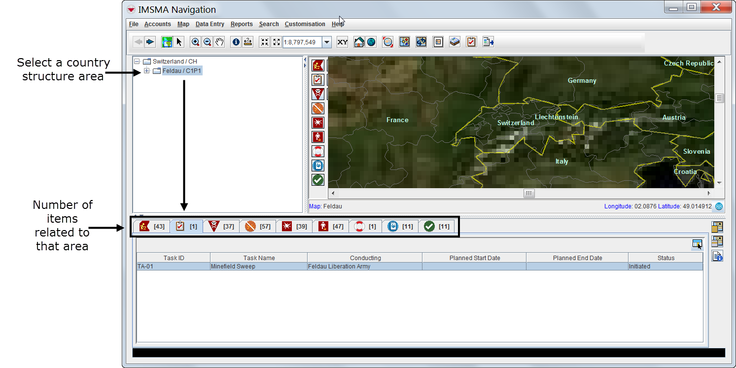
The IMSMA Navigation window has three panes: the country structure pane, the map pane and the items pane. The three panes work together. Users can browse through elements of any pane to view additional data appropriate to the kind of data the other panes hold.
The items pane displays most recently approved information. Each item has its own current view window that can be opened to browse for linked information and historic details. Throughout IMSMANG, functions and features display in smaller windows over the IMSMA Navigation window.
Interacting with Panes
| How To |
|---|
|
{{#if:View the Menu Bar Options | |}}{{#if:Display Item Records in the Items Pane | |}}{{#if:Display Records for a Country Structure Area | |}}{{#if:Expand and/or Collapse a Country Structure Area Node | |}}{{#if:Display the Icons of Item Records on the Map | |}}{{#if:Enable a Map Theme | |}}{{#if:Display Geospatial Data for an Item Record on the Map | |}}{{#if:Display Data for a Selected Item Record | |}}{{#if:Identify Selected Item Records and Icons | |}}{{#if:|
|
- Selecting the country structure area of your choice

- Displaying items on the map
- File:VaB02.png
| Represents a tip or note for using IMSMA Mobile. | Items with a grey background in the items pane do not have geographic coordinates and they cannot be displayed on the map. |
| File:VaB03.png | |
- Identifying an item from the map
Viewing Additional Data on the Map
| How To |
|---|
|
{{#if:Enable an IMSMA Theme | |}}{{#if:Change IMSMA Theme Display Properties | |}}{{#if:Change the Display Order of IMSMA Themes | |}}{{#if:Display the Item Icon on the Map from the Current View | |}}{{#if:View the GIS Map Toolbar Options | |}}{{#if:View the Previous and Next Map in the Series | |}}{{#if:Select Icons on the Map | |}}{{#if:Display the Area and Length of a Polygon | |}}{{#if:Identify Objects on the Map | |}}{{#if:Measure Distance on the Map | |}}{{#if:Reposition the Map Image | |}}{{#if:Lasso an area on the Map | |}}{{#if:Zoom in on and Recentre the Map | |}}{{#if:Change the Map Scale | |}}{{#if:Display the Map at a Larger Scale | |}}{{#if:Display the Map at a Smaller Scale | |}}{{#if:Recentre the Map to Coordinates | |}}{{#if:Display the Original Map View | |}}{{#if:Change the Map Projection | |}}{{#if:Display the Full Extent | |}}{{#if: Change the Coordinate Reference System Display | |}}{{#if:Refresh the Map | |}}{{#if:Control the Page Layout | |}}{{#if:View the Map Layout Toolbar Options | |}}{{#if:Control the Coordinate Display | |}}{{#if:|
|
- Using the map tools
| Represents a tip or note for using IMSMA Mobile. | Using the map tools activates the map status bar in the bottom of the IMSMA Navigation window. |
- Displaying items by subcategories
- File:VaB07.png
- Displaying auxiliary data
- Displaying labels
Browsing the Items Pane
Rearranging Displayed Items
| How To |
|---|
|
{{#if:Select Display Columns | |}}{{#if:|
|
Displaying New Column Headings
Viewing a Specific Item Current View Window
| How To |
|---|
|
{{#if:Access the Current View Windows | |}}{{#if:View a Field Report from the Current View | |}}{{#if:Print an Item from the Current View | |}}{{#if:Display the Item Icon on the Map from the Current View | |}}{{#if:Display the Item Associated Location View | |}}{{#if:Display Data for a Selected Item Record from a Location View | |}}{{#if:|
|
| Represents a tip or note for using IMSMA Mobile. | Current view windows can be customised and may present different tabs and summary headings. Contact your local administrator if you cannot find the links table. |
Viewing Linked Items of the Selected Item

| Represents a tip or note for using IMSMA Mobile. | Links reflect the reconciliation steps performed before the approval of the selected item. For more details on reconciling and approving data, see Reconciling and Approving Data in IMSMANG. |
Viewing Historic Details
Browsing Locations
| How To |
|---|
|
{{#if:Display Data for a Selected Item Record from a Location View | |}}{{#if:Change the Status of a Selected Item Record | |}}{{#if:|
|
Browsing Tasks
| Represents a tip or note for using IMSMA Mobile. | Tasks do not display in current view windows. |
Viewing Auxiliary Data Lists
| How To |
|---|
|
{{#if:Access the Explosive Ordnance List Window | |}}{{#if:Filter the Explosive Ordnance List | |}}{{#if:Access the Organisation List Window | |}}{{#if:Filter the Organisation List | |}}{{#if:Access the Place List Window | |}}{{#if:Filter the Place List | |}}{{#if:|
|
- Choose Data entry > select an auxiliary data type.
| Represents a tip or note for using IMSMA Mobile. | Lists of auxiliary data provide direct access for adding new data or editing existing data. |