Enter Geospatial Data in the Data Entry Form
From IMSMA Wiki
Geospatial data for a Data Entry Form is entered by clicking the File:Pencil.png button on the Data Entry Form Editor window.
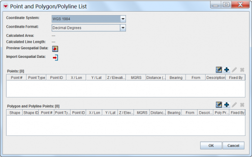
This displays the Point and Polygon/Polyline List window.
Point and Polygon/Polyline List Window
There are numerous options for entering geospatial data into a Data Entry Form. These options include:
- Entering the data manually
- Drawing on the map
- Importing data from a spreadsheet
| |
For more information about geospatial data entry, refer to Geospatial Data. |
