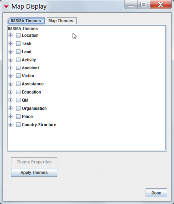
To use the Map Display window, you must have access to the Map Display permission.
The IMSMA themes toolbar allows you to control the icons displayed on the map. The IMSMA Themes tab in the Map Display window allows you to control these same icons and also the specific subcategories of icons that are available for the item. You can also control the display of topography, political boundaries, and raster files via the Map Themes tab.
To view the Map Display window, click the ![]() button, or open the Map menu and select Map Display. The Map Display window has two tabs. The IMSMA Themes tab contains the themes that are included with IMSMA. The Map Themes tab reflects the layers of the .mxd map file.
button, or open the Map menu and select Map Display. The Map Display window has two tabs. The IMSMA Themes tab contains the themes that are included with IMSMA. The Map Themes tab reflects the layers of the .mxd map file.
Map Display Window
The themes are organized in a tree format. If the checkbox to the left of the theme name is checked (![]() ), the theme displays on the map. If the checkbox to the left of the theme name is unchecked (
), the theme displays on the map. If the checkbox to the left of the theme name is unchecked (![]() ), the theme will not display on the map.
), the theme will not display on the map.
